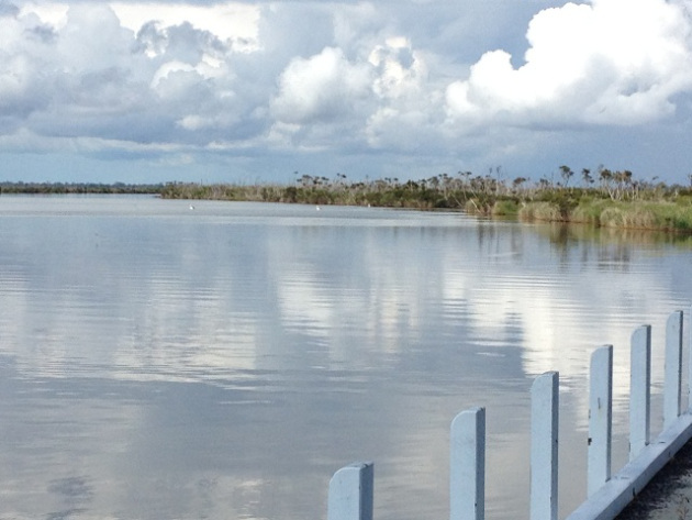
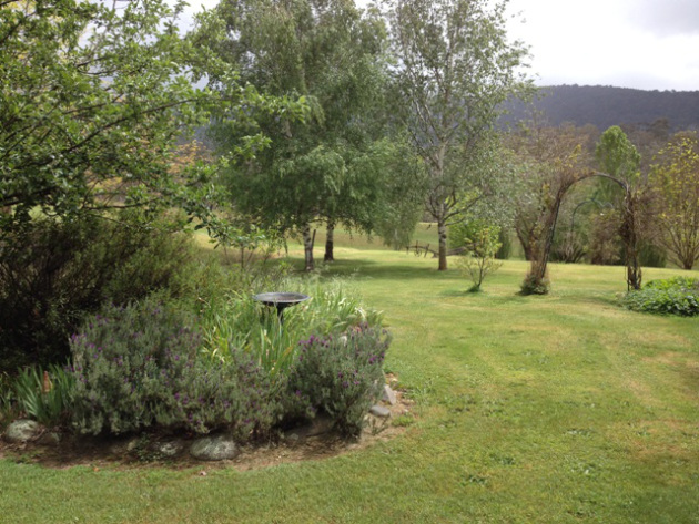
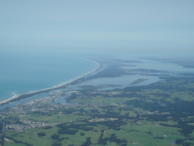
Bridport is on the north east coast of Tasmania, a pretty fishing village with many small cove like beaches.
The caravan park and camping ground extends for ever along the foreshore but was cost prohibitive for me at $25 a night for an unpowered site. It did have lovely beach/bush camping areas though.
There are extensive walking tracks around the area and along the waterfront that direct you to some of the local historical landmarks like the old jetty.
The Old Jetty, Bridport
There is lovely safe swimming here in what is delightfully called Mermaids Pool, naturally created by the rocks and the tide. It makes you wish you were a mermaid!
At the entry to the town you cross a small inlet where a couple of fishing boats are moored and I also noticed fish hatchery ponds on the way in.
I love the look of these old jetties when you look up the creek the other way! They don’t look too substantial, do they?
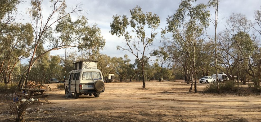
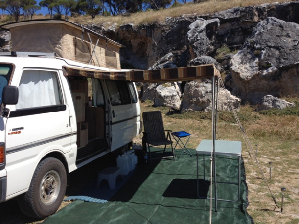
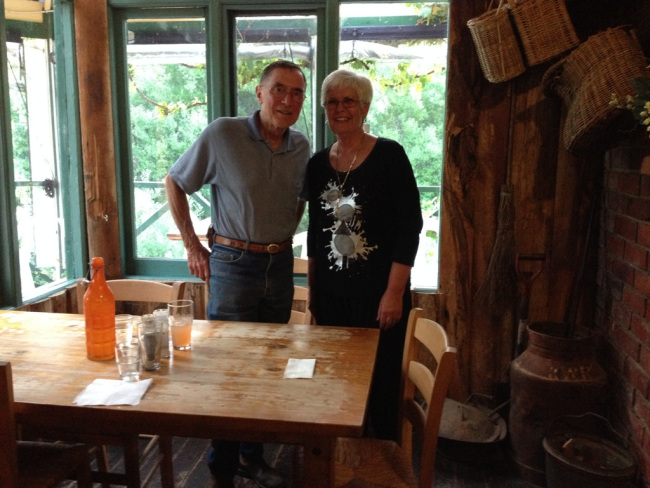
I was in Bridport to get the canvas replaced on Brutus the Beast, my pop top campervan and I can highly recommend Kerry, the Canvas Man from North East Canvas if you need any canvas work done. I know some of my travelling buddies have often needed awning repairs etc, so he’s your man when you’re in Tasmania! He was so quick - within 24 hours the old canvas was gone and a brand new PVC ‘hat’ was installed.
Happy Campers: There is no free camping in Bridport and the caravan park has a monopoly on waterfront locations. There is free camping at Scottsdale, just 20kms away, but that is the subject of another blog!
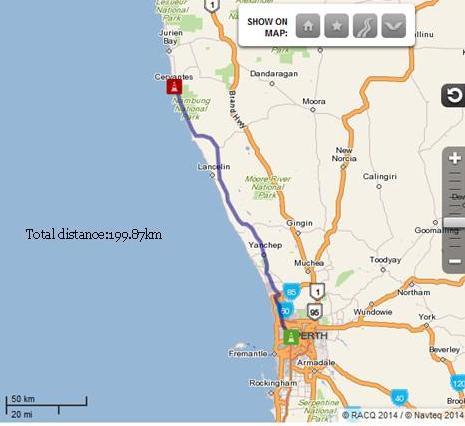
Cervantes is a fishing village about 200kms north of Perth and is famous for its rock lobsters! Unfortunately, I couldn’t afford to eat one, but those that did said they were pretty good. I’m glad I didn’t have any because I notice that the rock lobster season is due to begin, so I’m hanging out for a fresh one!!
I was interested to find out how Cervantes got its name and found this fantastic website that gives the history of names in WA. This is what it said about Cervantes
The townsite of Cervantes, a fishing settlement on the west coast near Jurien Bay and Nambung National Park, was gazetted in 1963. It is named after nearby Cervantes Islands, which in turn are named after the “Cervantes”, an American whaler, wrecked just north of the islands on the 20th July 1844. The “Cervantes” was under the command of Captain Gibson at the time of the shipwreck and the survivors walked about 160 km south along the coast to Fremantle. At the time of naming of the townsite it was thought that the islands had been named “Cervantes” by the Baudin Expedition of 1801-03 after a Spanish author, and, as a result, many of the streets received Spanish names.
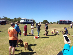
This little town, population around 500, grew by about 50% when the West Coast Rally began, and approximately 170 motorhomes of all shapes and sizes turned up - and about 280 people all shapes and sizes turned up too! You can imagine what a boost these sort of gatherings have on the economy of a small town like this – fuel, gas, souvenirs, eating out, tourist trips….. We all put our shopping dockets in a barrel so I’m sure there will be a report at some stage about how much we spent in the town while we were there.
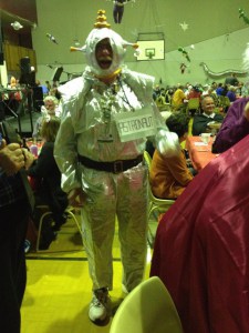
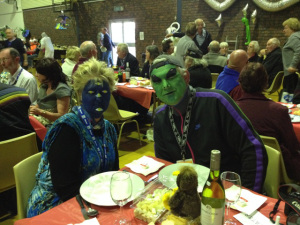
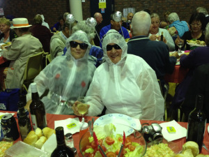
The rally kicked off on Thursday, October 9 and we braved the wind to set up our camps. The Solos were well represented by lots of Willie Wagtails and a few extras, like myself, from other parts of Australia. The theme of the rally was Aliens and UFO’s, so at our dinner on Saturday night we dressed to the theme.
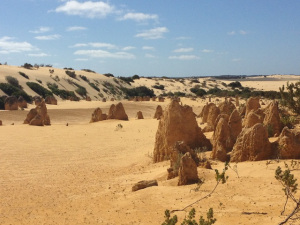
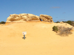
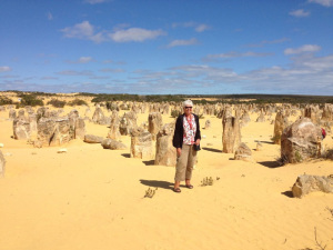
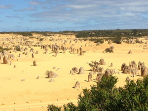
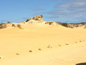
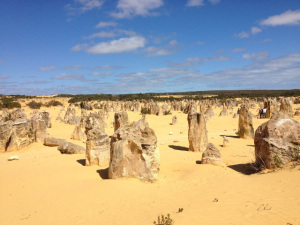
Earlier that day a bus load of us went off to The Pinnacles.
The Pinnacles Desert
So how did these strange pinnacles form?
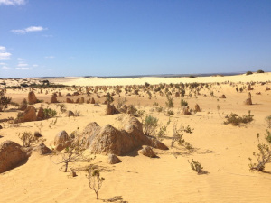
A set of unique circumstances produced the pinnacles. Firstly the huge sand dunes stabilised. The rains which fell on the dunes leached down through the sand carrying the calcium. This resulted in the lower levels of the dune solidifying into a soft limestone. As this stabilisation occurred a layer of soil formed on top of the dune which allowed plants to grow and further cemented the limestone below. Gradually the lowest layer of soil, which lay between the surface and the limestone, formed into a hard cap which resulted in the old dunes having three levels - a soil and plant level near the surface, a hard cap below the surface, and a thick layer of soft limestone at the bottom of the dune.
Inevitably the roots from the plants on the top level found cracks and broke up the hard cap and the layer of soft limestone. The result was that under a surface covered with plants and soil the pinnacles developed. No one knows for sure how long ago this process occurred. It may have started as long ago as 500 000 years but equally it may only be a few thousand years old and it may still be continuing today. The Western Australian Museum has opted for some time in the last 80 000 years.
Anyway the advent of drier weather in the region resulted in the top layer of plants and soil being removed and gradually the pinnacles were exposed so that today they stand like strange sentinels on a plain of wind blown sand.
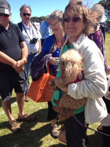
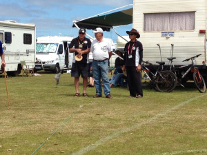
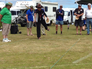
Disc Bowls was a popular activity and championships were held over the weekend, along with a Pet Parade.
After a few days of fellowship with like minded motorhomers we all went off in our various directions on Tuesday. I headed straight back to Cliff Head, one of my favourite camping spots in this area, and set myself up for a few days R & R.
After leaving Lucky Bay I headed back to Esperance to find a Laundromat, and washing done and dried I travelled towards Ravensthorpe. I hadn’t really thought about where I would stay tonight, but checked out my Camps Book and settled on Munglinup Beach.(NO phone, NO internet!) I hated it! Not fair, I suppose, to make such a judgement because I only stayed overnight, but the road in for about 19kms was rough and dusty corrugation, I wasn’t feeling 100%, the beach was covered in weed, and it was late in the afternooon when I got there and I kept thinking about that horrible road that I had to go out on the next day. I couldn’t wait to leave and get it over with so I was up early the next morning and headed back along that bone-shattering red dust road.
WikiCamps came up with my next overnighter – Tozers Bush Camp on the way to Bremer Bay. I am so sorry I didn’t take any photos here to show you the fanastic set up here.
Funny how something makes you lean favourably toward one thing or another. As a kid we had camping friends by the name of Tozer, and as the reviews in WikiCamps were ok I rang ahead and Robert Tozer assured me there was a spot for me. There was a spot alright – I was the only one there! What a shame this place isn’t better known. Robert has done a great job levelling a lot of sites and has built one of the best amenities blocks I have ever seen. Fantastic hot showers and toilets – luxury - and you should see the Happy Hour/Camp Kitchen he has there. It’s massive, with a huge deck that overlooks his land, and great facilities inside. I finally had internet access here, basically for the first time at a place I had stayed since the start of my journey about two weeks ago . That alone was worth the $20 a night fee – which is probably a bit over the top for what is there. I wish there had been more campers here to enjoy the Camp Kitchen and Happy Hour with, but Robert left to go back to his home in Bremer Bay and I was left with the internet and a brilliant night sky for company. He did say, though, that when the wildflowers are in bloom, he expects his camp to fill up and he has made walk trails over the property for his guests to make the most of what he has to offer here.
I must admit I was a little nervous for the first time ever as I really was in the middle of no-where, and alone! That is, except for the big green frog in the toilet! I left Robert a copy of my Green Frog poem when I departed the next day.
I decided to head to Cape Riche for a few days, and what a good choice that turned out to be. (apart from NO phone and NO internet again).
The little birds were really friendly here and hopped all around me - they were kind enough to let me take a couple of photos, too. The one on the left is a White Browed Scrub Wren and the one on the right is a Splendid Blue Wren that becomes a vivid all over blue when it is mating - little show off!
Found this photo on the internet to show the colour that little fellow becomes when he is breeding. Now, what female could resist him!
I spent a couple of quiet days here and on my last night I was invited to Happy Hour at a neighbouring camp. When I got there I discovered there were three guys on a fishing trip – and me! I drank far too much red wine and staggered back to my camp in my wobbly boots after Noel, Peter and Nigel had cooked up a storm for dinner, which they shared with me. Feeling much the worse for wear the next day I started the day with Panadol and a bottle of water but think I probably should have had it the night before instead of all that wine! The fellas cooked me bacon and eggs for breakfast the next day and while they headed off with their boat to catch some fish I packed up and I was ‘on the road again’!
The amount I am spending on petrol is killing my budget – I need to find a place and just prop for a while. I decided to go to Parry Beach.
After shopping for some supplies in Norseman I decided to head south towards the South-East Coast of Western Australia, with an overnight stop at Salmon Gums. (NO phone, NO internet). It is named after the beautiful salmon gum trees in the area.This is a small community run caravan park with hot showers, clean amenities, some powered sites and a laundry with washing machine. There was only one van there when I pulled in and no-one around but it wasn’t long before some caravanners, Bob and Carol, arrived. (No Ted and Alice!) It was only $5 for an unpowered site so I did some hand washing, hung it on the line and decided to stay.
There were no flies, which was a bonus, but there lots of little bitey ants. The next morning my washing wasn’t dry so I hung around and it wasn’t long before more vans pulled in. We all started chatting and I decided to stay for another night and enjoyed a great Happy Hour with new found friends. John and Helen were one of the other couples and Helen and I started talking blogging. Helen has a travel blog called www.magfowl.com which is really interesting.
It was Saturday when I left and headed to Esperance to stock up the cupboards and fill my gas cylinder to keep the fridge running. I shopped first – big mistake! After midday there is no-one that will fill a gas cylinder and the only changeovers available were 9kg and I needed a 4kg one. On the recommendation of a friendly customer in the last servo I went to looking for gas, I headed off the 65kms to a little place called Condingup. Yes, they would fill a gas bottle for me! I’m now on my way to Lucky Bay after a 130km round trip for gas. As I came over the crest of a hill Lucky Bay came into view and I thought, yes, this has been worth the hassle.
Coming in to Lucky Bay
The beaches along here have been voted the whitest sand beaches in Australia and it’s easy to see why. The pure white sand disappeared in to clear aqua waters, the bays curved towards rocky headlands, the Recherche Archipelago was just off-shore – it was picture postcard perfect. See what the WA Parks people have to say about Lucky Bay in the Cape Le Grand National Park here. There’s also some wonderful photos on this web-site and links to other bays in the area.
I enjoyed four beautiful days here for $6.60 per night (plus National Park fees). (NO phone, NO internet).There is a solar shower, a great camp kitchen and believe it or not a coffee van that sets up on the beach most days about 10 o’clock. John and Helen came to visit me while I was there and booked out of their Esperance Caravan Park and camped nearby at Cape Le Grande. My fitness neighbour, Richard, joined me for a walk along the beach one day and we shared Happy Hour that evening before I left the next day.
The other beautiful thing about this camp was the birds and I was really excited to see a stunning finch called a Red-eared Firetail. Typically I didn’t get a photo - all the birds I aim the lens at are extremely camera shy, but I found this one on the internet and can guarantee this is exactly what they look like.
As I was packing up my camp one of the camp ground kangaroos got upset with me and growled! Did you know they do that? I thought they only made Skippy noises and I got a hell of a fright. Anyhow, a few days later I wrote my first children’s poem called The Angry Kangaroo. I won’t include it here, but you will find it on the Poetry page of my blog.
Here are a couple of kangaroos that made themselves at home around the camp.
Lucky me – I had spent a wonderful four days in Lucky Bay!
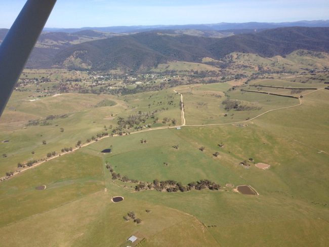
It was later in the day when I left Sale and I was pretty tempted to just cross the road and go to the Showgrounds, but there’s no adventure in that so out came my Camps book and I headed off to Marlay Point. The wind was blowing a gale but I was camped right on the foreshore of Lake Wellington and I loved being near the water.
An early start the next day gave me plenty of time to have a look at Hollands Landing which is also a camping spot.
I’ll have to paint those clouds one day!
I arrived in Bairnsdale, did some shopping and headed off towards Omeo and beyond to spend a few days with my old school friend Russell.
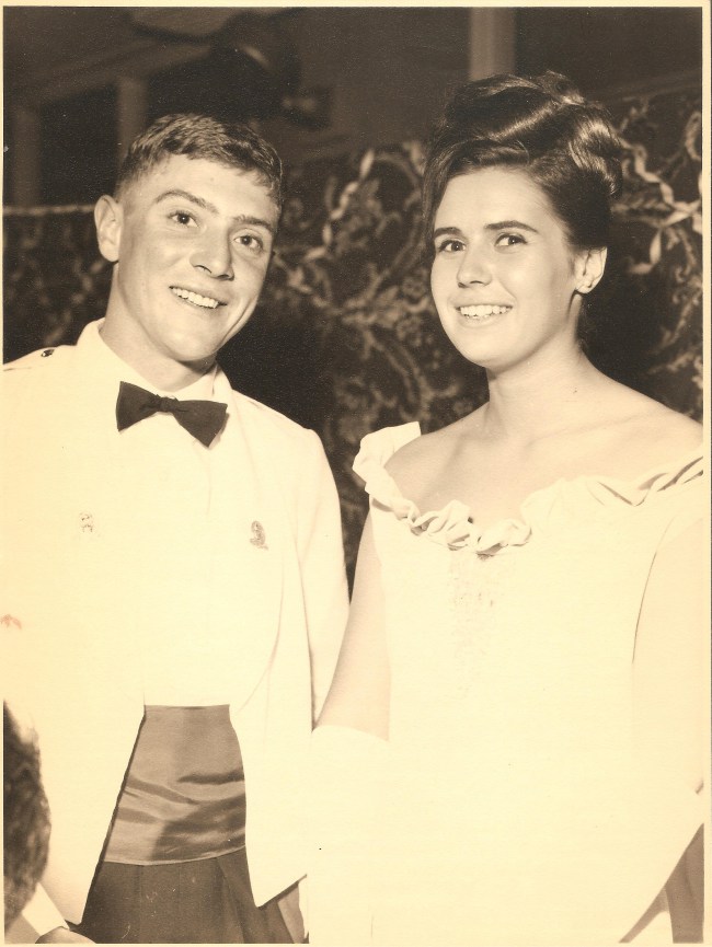
When Russell left school he joined the army and attended Officer Cadet School at Portsea and I was honoured to be his partner at his graduation in 1965. We had lost contact for many years and when our old school had a reunion a few years ago we made contact again and have kept in touch ever since. I’m so lucky to have such long-term friends in my life.
On the way I had another overnighter at Swifts Creek, a pretty little camping ground with power, lovely hot shower and clean facilities. To stay there you had to pay $14 at the General Store in town. I’m really getting sick of the drizzly rain that always seems to come down as I am preparing for dinner and should have done what my neighbour, Chook, did and go to the pub for tea. Chook comes from Morwell and also travels alone with her 2 little dogs. She was interesting, although brief company.
Swift’s Creek camping ground
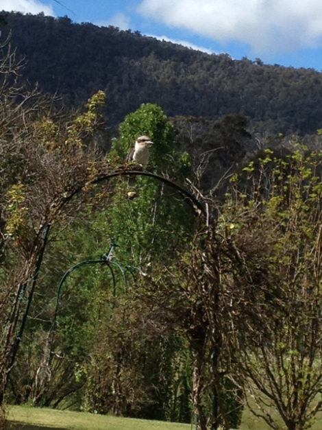
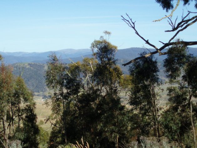
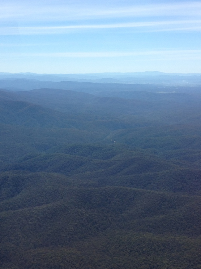
I headed off up the mountain early the next day going through Omeo then turning off at Angler’s Rest towards Russell’s home at the foot of the Bogong High Plains. There is 10kms of corrugated dirt road to Russell’s place and poor old Brutus showed his displeasure by throwing open my cupboards and tossing stuff around on the floor! Russell’s property is surrounded on 3 sides by National Park and is an idyllic location. I spent hours trying to identify the birds that cheekily landed on us as we sat on the veranda ‘chewing the fat’. The cheekiest of all were the grey fantails, but there were also crimson rosellas, blue wrens, kookaburras and a little bird I couldn’t identify that had the sweetest song. I’d stalk it around the garden trying to catch a glimpse of it but it was too elusive for me!
I took this next photo the day we went collecting wood to stockpile for next winter. I reckon it looks like a Frederick McCubbin painting!
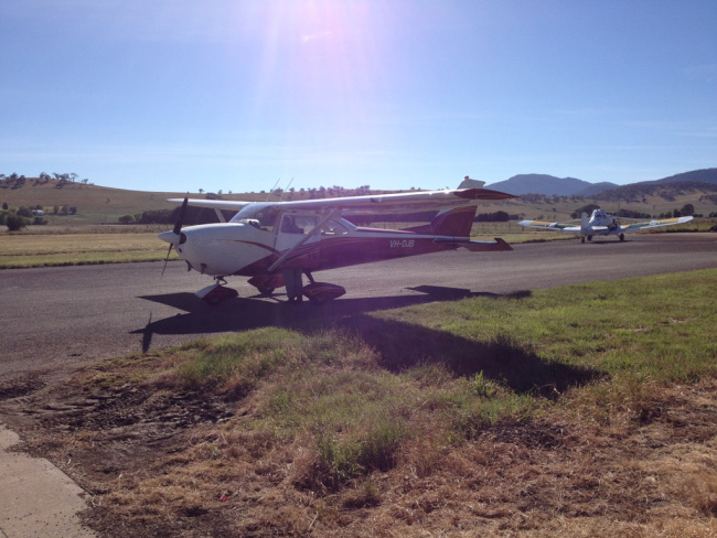
Wednesday was an amazing day! Russell has a plane, a Cessna 172, and we went over to his hangar at Benambra and he took me for a flight over the coastline around 90 mile beach and Lakes Entrance before heading back over the mountains to home. On the way to Russell’s plane we stopped at McMillan Lookout which he likes to do to get a ‘visual’ of the local weather conditions.
And then the time had arrived to prepare the plane and take to the skies!
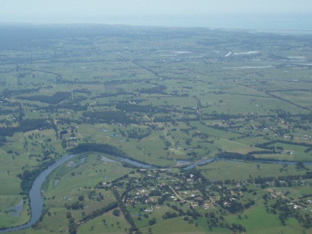
Omeo township
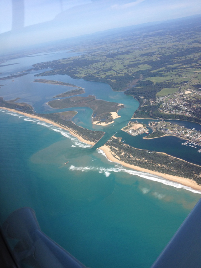
Lakes Entrance
Coming in to Bairnsdale
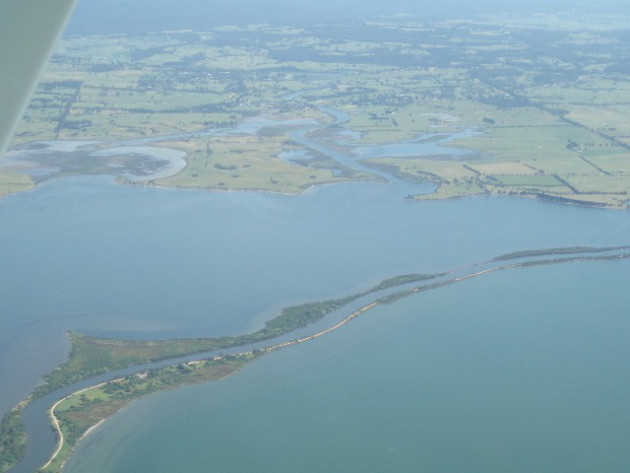
The Silt Jetty
The Mitchell River Silt Jetties are the second largest in the world, after those at the mouth of the Mississippi River as it enters the Gulf of Mexico, and have been nominated as a site of international significance. The Silt Jetties extend out from the western shore of Lake King about 6 km north-east of Paynesville.
From Eagle Point Bluff the Silt Jetties become a series of long, narrow, winding silt jetties which extend eastwards out into the lake for 8 km. There is a part bitumen/part gravel road all the way to the end, with many favourite fishing spots along the way. The silt was deposited over millions of years when the Mitchell River slowed as it entered Lake King. The jetties are also home to a large range of native animals and birds.
Flying home we were heading back into the mountains. Russell calls this Tiger Country - no where to land!
That night we went to The Blue Duck, the pub at Anglers Rest. As it is trout season there were trout fisherman all dressed up in their gear hoping to catch the BIG one. Russell told me a funny story about the publican who had been feeding up a brown trout for a few weeks waiting for the season to start so he could throw in his line and catch it. Meanwhile his daughter swung from the rope in the tree into the river, belly flopped and landed on the fat trout, stunning it. So she lifted it out of the water and took it to her dad asking what she should do with it. Dad was mortified – all that time he’d been cultivating that trout to catch it himself and his daughter catches it with a belly flop!
Here’s another ‘before’ and ‘after’ photo, the first taken at Russell’s graduation in 1965 and the second, obviously, a lot more recently at the Blue Duck.
I left this peaceful haven the next day and headed to Sale to see my Aunty again and then make my way back to Melbourne. That night I stayed at a second cousin, David’s, place in Sale. I’m not sure if I’ve met David before or not. If I have it was a long time ago so it was wonderful of him to welcome me into his beautiful home, where I met two of his sons, Toby and Henry, and also his housekeeper, Bev.
On the way back into Melbourne I caught up with Laurance, a fellow Solo and he worked his magic on Brutus and adjusted the timing for me so once again he’s running like a dream.
My next adventure takes me to Tasmania where I will spend Christmas with my sister Marion and hopefully see as much of the countryside as I can while I am there. I leave on December 4th and plan to stay for at least a couple of months. I’m looking forward to sharing my Tassie experiences with you…
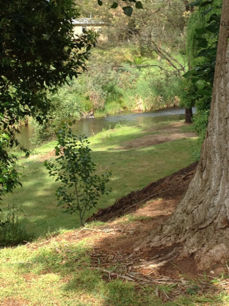
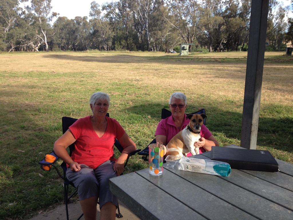
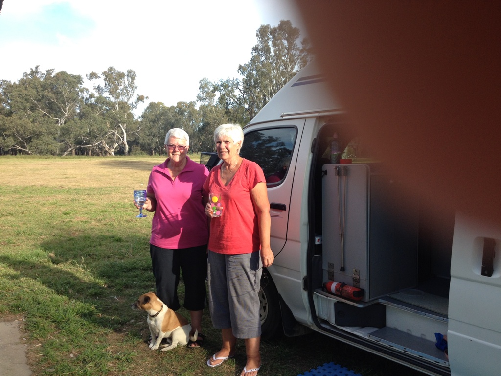
You know, sometimes you find a camp spot that you’d be happy to spend a bit of time at, and this is one of them. Right on the banks of the river it was a lovely clean, mowed area with picnic tables, a toilet (composting) and water - and plenty of room to camp without being on top of someone else.
Marion and I were a bit cheeky and pulled up either side of a covered picnic table and claimed it as our own while we were there. It wasn’t a problem as it was mid-week and not a lot of people around.
This photo MUST have been taken after 4pm - it looks like Happy Hour is in full swing by the level of my vodka and tonic!
We were camped near some lovely people from Yeoval and they were amazed when I said I had been there - quite by accident of course - when I was bringing Brutus home to the Gold Coast not long after buying him. You’ll have to read my first blog if you want to catch up on that story!
I know, this photo has a fingerprint on it, but it’s one of the few I’ve got outside Marion’s van.
Sandy Beach is on the banks of the Murrumbidgee River, which Jack made the most of by having several swims. He loves the water almost as much as he loves sticks to play with. And sticks and water together - dog heaven!
We had a couple of lovely days here, the weather was good, the facilities fine, Jack was a happy dog - and I think Marion is getting into the swing of this. A camp site like this certainly helps! If I hadn’t needed to fill up my gas bottle I could have easily stayed a few more days.
Day 5 - Arriving at Wagga Wagga
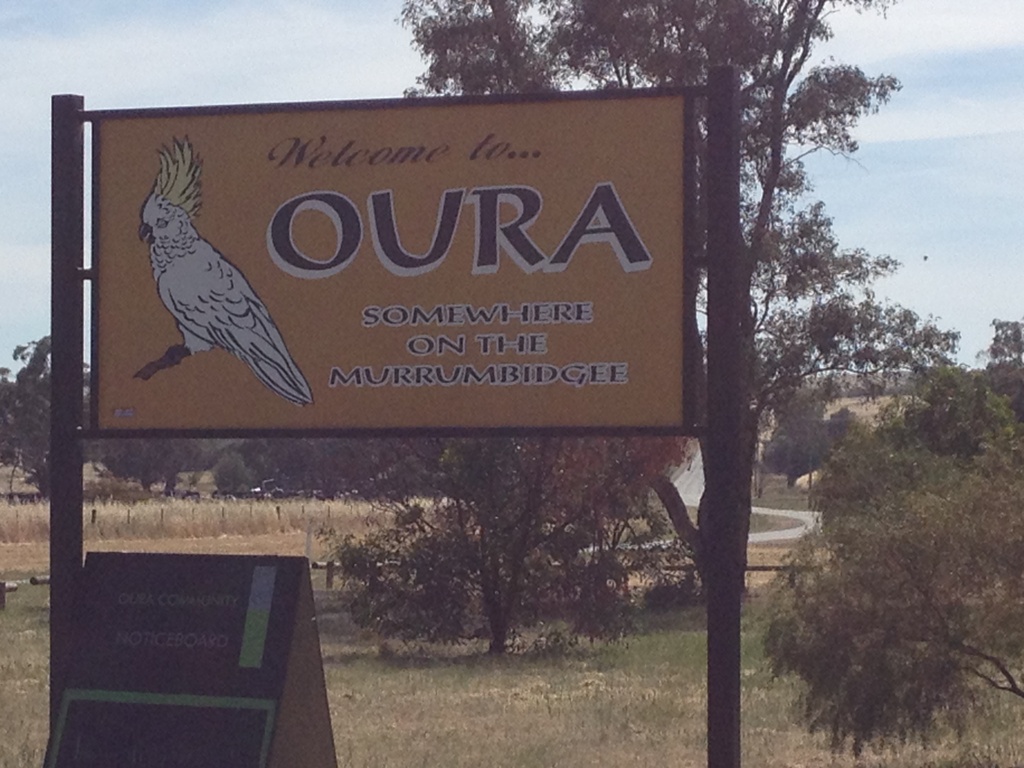
Wagga Wagga wasn’t far away so we checked out one of the other freedom camps at Oura Beach on the way there. It had a few more people staying there but once again looked like a good place to go. It was a little closer to Wagga Wagga than Sandy Beach, too. Love the sign going into town!
As you come into Wagga Wagga there is another free camp right on the edge of town at Wilks Park, but I’m so glad we have a cousin here and we were able to stay at their home on acreage a little way out of town. Wilks Park was right on the highway, and although it had good facilities and gave easy access into town, it was crowded and noisy.
Being here was a wonderful opportunity to catch up with Gretchen and Richard, and Marion was thrilled that Richard was able to fix a squeal in her air conditioning. A hot shower and shampoo was very welcome, too.
Jack met some cats for the first time in his life - and they soon let him know who was boss! His ball, another favourite toy, rolled into the horse paddock during one game and that was an interesting encounter to watch. The horse just wanted to be friends but Jack was very wary and couldn’t get out of there quick enough. That was the biggest dog he had ever seen!
We enjoyed a nice evening together before heading further south the next day. The Rutherglen wineries are not far away ……
I had a pretty early start from Julia Creek and with only about 135kms to Cloncurry arrived in plenty of time to do some shopping. While I was at the supermarket, Shirley, whose house I was going to look after in Mt Isa rang me, and when she heard where I was suggested I go to the bakery down the road for good coffee and great pies. She wasn’t wrong!
At the bakery I was sitting down enjoying my pie - you know how it is - hot pie running out all over your hands, burning your fingers off, you can’t lick them because you’re not sure when you last washed them, looking like a picture of elegance - have you got the picture? I was in a mess! A face appeared in front of me and said, “Rosemary?” It was Lorraine and Rod, caravanners heading to Darwin who I had met at Bedford Weir and last seen at Emerald. What a lovely surprise!
We sat down and had a coffee together and caught up on each other’s adventures. They had travelled here via Longreach and Winton, the way I will go when I leave Mt Isa. I was telling them about Julia Creek and how much I enjoyed it so they back-tracked and spent a few days there, which they thoroughly enjoyed. I am so glad - you know what it’s like when you recommend something - it can be disastrous.
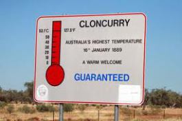
Thank goodness it wasn’t this hot while I was here!
Hottest temperature recorded in Australia
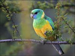
Cloncurry Parrot
The Cloncurry parrot is only found in the Cloncurry area in North West Queensland and is a member of the ringneck family of parrots.
Cloncurry is locally called ‘The Curry’ and here’s some information I found out about it.
Cloncurry breathes cattle and has copper and gold in it’s veins. in 1867 Ernest Henry and Roger Sheaffe started a joint pastoral-mining venture on the banks of Cloncurry River, named by the ill-fated explorer Robert O’Hara Burke in 1861. The town was proclaimed in 1884 and boomed into the 20th century with merchants, carriers, miners, builders, bakers and battlers. Cloncurry was the biggest, boisterous town in the outback Queensland between 1880s and 1960s. During WW1 Cloncurry was the main source of Australian copper, with 7000 people working many mines and four smelters.
Cloncurry is a lively, multi-racial town. Aboriginal people have intermarried with European, Chinese and Afghan newcomers for the past 120 years. In 1900 Cloncurry was a Ghantown with 200 Afghans working over 2000 camels. Chinese market gardens also bloomed along Coppermine creek.
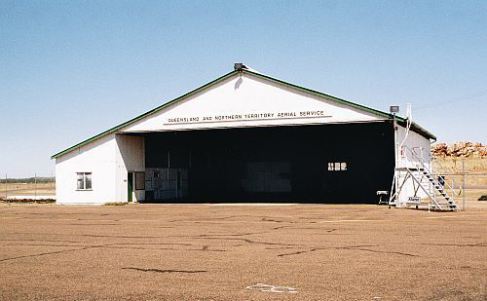
Cloncurry has the original hanger with Queensland and Northern Territory Aerial Service (Qantas) still on the front. There is a monument to commemorate Qantas, which flew its first passenger (Alexander Kennedy) from Longreach to Cloncurry on November 3rd 1922 at a cost of 11 pounds 2 shillings.
The original Qantas hangar at Cloncurry airport
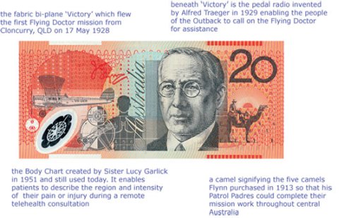
In 1928 the Royal Flying Doctor Service was established in Cloncurry by Rev John Flynn , choosing this town as his base because of its proximity to the mining camps and scattered pastoralists. At that time there were just 2 doctors providing the only medical care for an area of almost two million square kilometres. The RFDS now has 13 flying doctor bases around Australia and services about 6.9 million square kilometres, or 80% of the Australian continent. This is the most comprehensive aeromedical emergency and health care service in the world. You’ll recognise his face on our $20 note. Flynn was a Presbyterian minister and this picture has some great information about the images surrounding Flynn on the $20 note.
I’d forgotten to empty my porta-loo in Julia Creek so headed to the information centre to find out where the dump point was. This was not a good experience. Two very snooty ladies were manning the desk, and when they finally bothered to speak to me they informed me that I would have to book into the caravan park if I wanted to empty my toilet. They didn’t offer me any other information about the town, didn’t encourage me to look at any of their displays and I felt like it was a real effort for them to even acknowledge my presence. Needless to say I didn’t hang around there for long and decided to head to Corella Dam where I would spend the next 3 days before I arrived in Mt Isa.
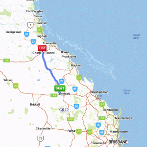
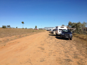
One night at the Sapphire free camp was enough as there was a horrible smell in the area - I think they were cleaning out the septic tank! So this site certainly wasn’t a ‘jewel’ in the crown of our travels. But now our little convoy numbered 5 motorhomes as we headed north to Charters Towers. This doesn’t look far on the map but it’s about 520kms!
Anakie Gemfields to Charters Towers
Our first stop wasn’t far up the road - a good looking cafe at Rubyvale that sold Merlo coffee - my favourite. We parked on the Common, which local live stock have the right to use and today we shared it with a few cows.
The coffee kept us going for while and our next stop was a very pretty, clean town called Capella.
Like so many outback settlements, the small, Peak Downs town of Capella began as a coachstop on the trails linking mining and agricultural producers with the coast and developed in rhythm with the dictates of the market. These days, Capella’s lifeblood are the black soil graziers and pastoralists and the regional coal fields. The pioneering squattocracy was attracted to the down country by explorer Ludwig Leichhardt’s glowing assessment of the agricultural potential of the grasslands he traversed in 1846.
Pioneer Village on the town’s northern outskirts traces Capella’s role in the fluctuating fortunes of the Peak Range and Peak Downs corner of central Queensland. The village displays include Peak Downs Homestead, a shingle-roofed cottage built in 1869 by artisans using adzed and pit-sawn local timbers.
The town takes its name from the reddish, eighth brightest star in the southern sky, while visitors are also attracted to sparklers of another kind on the gem fields just half an hour out of Capella.
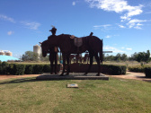
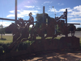
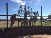
What I found even more interesting though was the role the locals played in the origin of the emu plume in the Light Horseman’s hat. There is a wonderful sculptural display along the main street and I found this little snippet of history when googling about it.
Sir David Fairbairn, grandson of George Fairbairn who now lives in Canberra, believes that the first time Australian troopers wore emu feathers in their slouch hats was at Peak Downs. The story goes that a detachment of Mounted Infantry troopers guarding a gang of ‘non-union’ shearers during the great shearers strike of 1891 rode down to the creek one day when things were quiet and shot an emu. Each took a handful of feathers and placed them in the band of his hat. From then on it became tradition for troopers to wear the emu feathers.
At that time, 1891, officers of the Queensland Mounted Infantry units wore green cock plumes in their felt hats, but the ‘other ranks’ had no plume. By 1894 however, all non-commissioned officers and men of all mounted Queensland units wore the emu plume, and, by 1897 they had replaced the officers’ cock plume.
The Queensland Mounted Troops took great pride in their plumes and seemed to gain great strength of spirit from them during the Boer War (1899 – 1902). Indeed, when Major General Edward Hutton ordered the wearing of helmets in place of the plumed slouch hat, he faced much pressure including that from strongly lobbied Federal Members of Parliament. This led to some individuality being retained when he renamed all mounted Australian troops the Australian Light Horse. The new Queensland based units became the 13th, 14th and 15th Australian Light Horse (Queensland Mounted Infantry). They retained their name and the right to wear the emu plumes as part of their uniform right through Commonwealth Forces uniform revisions up until 1912.
With the outbreak of WW1 (1914 – 1918), Lieutenant Colonel R.M. Stodart, the Commanding Officer of the 2nd Light Horse, campaigned all the way up to Prime Minister Fisher to successfully have the emu plumes reinstated as part of the Queensland Mounted Infantry uniform. He maintained the plumes were essential to the regimental corp spirit. The Queenslanders’ plumes were the envy of all other regiments until 1915, when the non-Queensland 3rd Light Horse Brigade arrived in Egypt wearing them.
The Queenslanders vigorously protested. A conference of Light Horse Brigadiers could not settle the matter so it was referred back to the Australian Government, which eventually ruled that all Light Horse Regiments could wear the plumes, provided there was no expense to the public purse. It can be argued that the emu plumes bolstered all Australian Light Horse corps spirits, as they had the Queensland Mounted Infantry.
The emu plumes are still worn by Armoured Units of the Australian Army today.
It was a very pleasant interlude in Capella and fascinating to read about its role in our Military History.
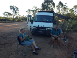
Clermont was the next main town we headed to, but Richard found a great camping spot by a river on the Gregory Highway, almost opposite the entry to the Blair Athol mine. He bought out his camp oven and we all threw in whatever we had and enjoyed a great meal together. Lawrence left us the next day to meet up with some other friends so we were now a safari of 4 vans.
Lorrie and Pam
Richard found our next camp spot too, which was a disused gravel pit north of Belyando Crossing. It was off the road, nice and level and out came the camp oven again.
Outside Clermont -Lorrie & Richard with his dog Sheila
Charters Towers was our next stop but on the way Richard peeled off so now it was just Pam, Lorrie and I heading to town to shop! It was great to stock up on some fresh food and water. When we left the supermarket Lorrie and Pam had decided to go Macrossan Park so even though it was about 20kms in the opposite direction to where I was headed I went there too.
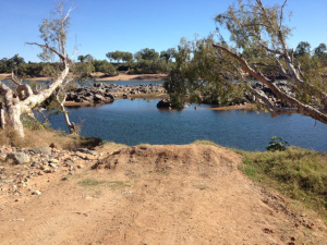
Macrossan Park on the Burdekin
Burdekin River
But I didn’t stay - it was dry and dusty and I decided to head back to my original choice, Fletcher’s Creek. This had appealed to me since I first planned my trip before I left Bundaberg. So I said goodbye to the girls and headed back into town to travel 42kms north to Fletcher’s Creek.